Intro
Andhra Pradesh, సాంప్రదాయిక అన్నిటికినీ పునరుద్ధారం సాధించిన సౌందర్యంతో ఒక అమూల్య ప్రాంతం. ప్రాంతంలో కోట్లు జనాభాతో, సాంప్రదాయిక పట్ల సాంప్రదాయికతను మిశ్రమం చేస్తుంది. ఈ ప్రాంతంలో ప్రాక్కల చిరునామా ప్రాక్కలు మరియు సమాచారంతో కూడిన అన్నిటినీ ఒకటిగా సందర్శించండి.
Facts about Andhra Pradesh |
|
|---|---|
| స్థాపన | 1 నవంబర్ 1956 |
| రాజధాని నగరం | అమరావతి |
| ప్రాంతం | ప్రాంతంలో 160,205 చ. కి. మీ |
| జనసంఖ్య | 54 మిలియన్ల పైగా అధికము |
| అధికార భాష | తెలుగు |
| లింగ నిష్పత్తి నిర్ణయం | 1000 మంది పురుషులకు 997 మంది మహిళలు |
| పఠన రాట్ | 67.35% |
| GDP (నోమినల్) | ₹13.7 ట్రిలియన్ (US$170 బిలియన్) |
| GDP (PPP) | $240 బిలియన్ |
| ముఖ్యమంత్రి | వై.యస్. జగన్మోహన్ రెడ్డి |
| గవర్నర్ | బిస్వభూషన్ హరిచందన్ |
| సభ | 175+58 సీట్లు |
| లోక సభ | 25 సీట్లు |
| రాజ్య సభ | 11 సీట్లు |
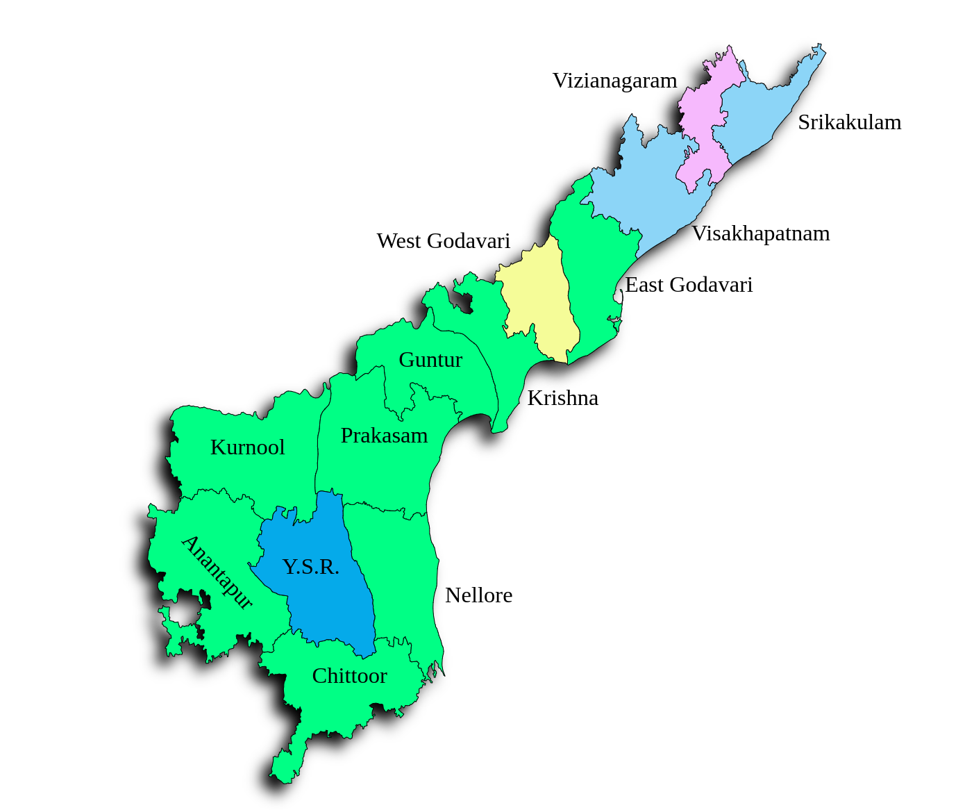
Andhra Pradesh is a state located on the southeastern coast of India. It shares its borders with Telangana, Odisha, Tamil Nadu, Karnataka, and the Bay of Bengal. Understanding the map of Andhra Pradesh is essential for travelers, history enthusiasts, and anyone curious about the rich cultural heritage and natural beauty that this state offers.
Andhra Pradesh is blessed with diverse geographical features, ranging from the scenic coastline of the Bay of Bengal to the Eastern Ghats mountain range. The state’s capital is Amaravati, and other major cities include Visakhapatnam, Vijayawada, and Tirupati. Telugu is the official language of Andhra Pradesh, and the state embraces a vibrant cultural tapestry with influences from various communities and traditions. Click to know more.
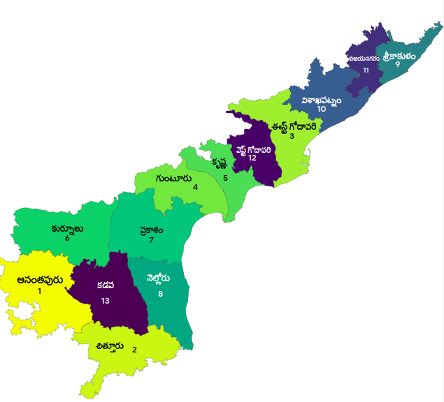
Andhra Pradesh Map in English | AP Map in English
Explore the Andhra Pradesh English map, an Indian state in the southeastern coastal part. It is India’s 7th largest state by area and 10th most populous state.
Andhra Pradesh Map in Hindi
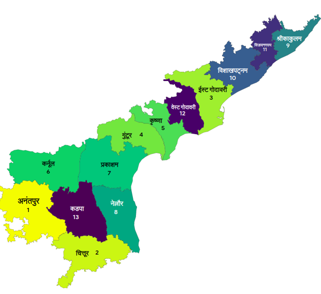
Explore the Andhra Pradesh Hindi Map for educational purposes.