About
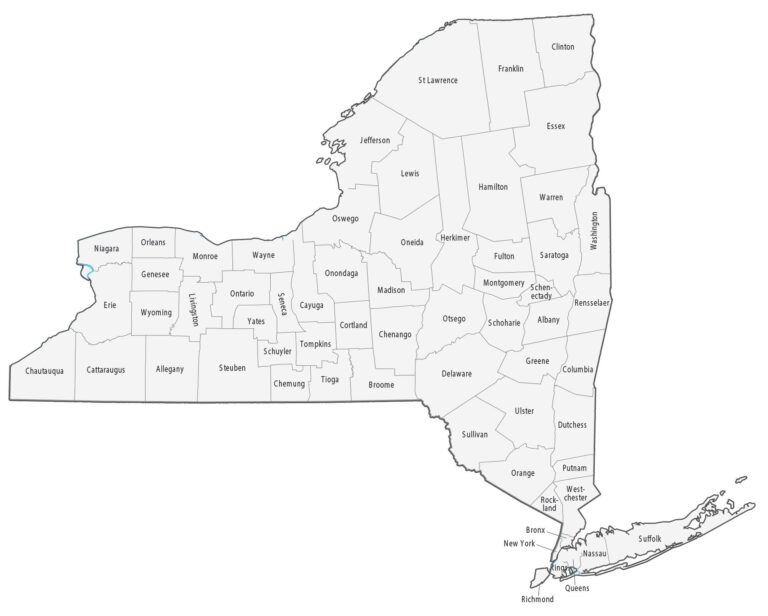
New York County Map is a graphical representation of the 62 counties that make up the state of New York in the United States. This map gives updated information about the geography and boundaries of New York’s counties.
New York Counties
New York has 62 counties.
Some most popular counties in New York are:
- New York County (Manhattan) – It is the most densely populated county in the United States and is home to many iconic landmarks and neighborhoods, such as Central Park, Times Square, Wall Street, and the Upper East Side.
- Kings County (Brooklyn) – It is located on the western end of Long Island, Brooklyn is the most populous borough of New York City, with a diverse population of over 2.5 million people. It is known for its unique neighborhoods, including Williamsburg, Park Slope, and Brooklyn Heights, and for its iconic attractions such as the Brooklyn Bridge, Coney Island, and Prospect Park.
- Queens County (Queens) – It is the largest borough of New York City by area and second-most populous, with over 2.3 million residents.
- Bronx County (The Bronx) – It is famous for the Bronx Zoo, the New York Botanical Garden, and Yankee Stadium.
- Richmond County (Staten Island) – It is known for its scenic beauty, historic Fort Wadsworth, and the Staten Island Ferry.
List of All Counties of New York
| County Name | County Name |
|---|---|
| Albany | Niagara |
| Allegany | Oneida |
| Bronx | Onondaga |
| Broome | Ontario |
| Cattaraugus | Orange |
| Cayuga | Orleans |
| Chautauqua | Oswego |
| Chemung | Otsego |
| Chenango | Putnam |
| Clinton | Queens |
| Columbia | Rensselaer |
| Cortland | Richmond |
| Delaware | Rockland |
| Dutchess | St. Lawrence |
| Erie | Saratoga |
| Essex | Schenectady |
| Franklin | Schoharie |
| Fulton | Schuyler |
| Genesee | Seneca |
| Greene | Steuben |
| Hamilton | Suffolk |
| Herkimer | Sullivan |
| Jefferson | Tioga |
| Kings | Tompkins |
| Lewis | Ulster |
| Livingston | Warren |
| Madison | Washington |
| Monroe | Wayne |
| Montgomery | Westchester |
| Nassau | Wyoming |
| New York | Yates |