About West Bengal
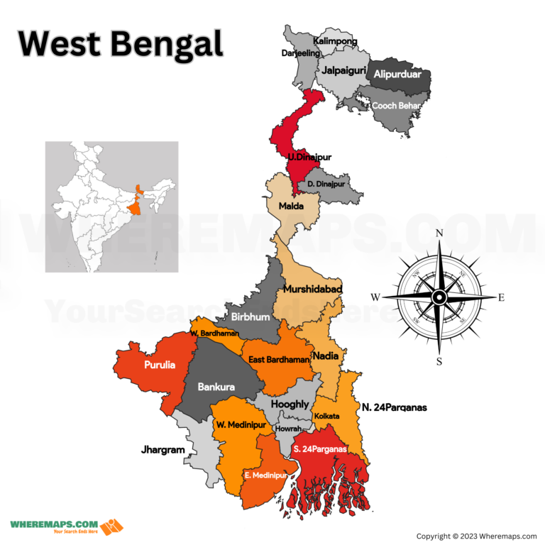
West Bengal is a state located in the eastern part of India. It shares its borders with Bangladesh, Assam, Sikkim, Bhutan, and Nepal. The state has 23 districts with unique culture, history, and geography. The districts are divided into three regions – North Bengal, South Bengal, and Kolkata. In this article, you’ll explore the names and locations of all the districts in West Bengal with our West Bengal District Map.
West Bengal Districts Facts |
|
|---|---|
| State | West Bengal |
| Capital | Kolkata |
| Official Language | Bengali |
| Number of Districts | 23 |
| Number of Divisions | 5 (Darjeeling, Jalpaiguri, Malda, Burdwan, Presidency) |
| Total Area | 88,752 sq km |
| Population (2011) | 91,347,736 |
| Current Chief Minister | Mamata Banerjee |
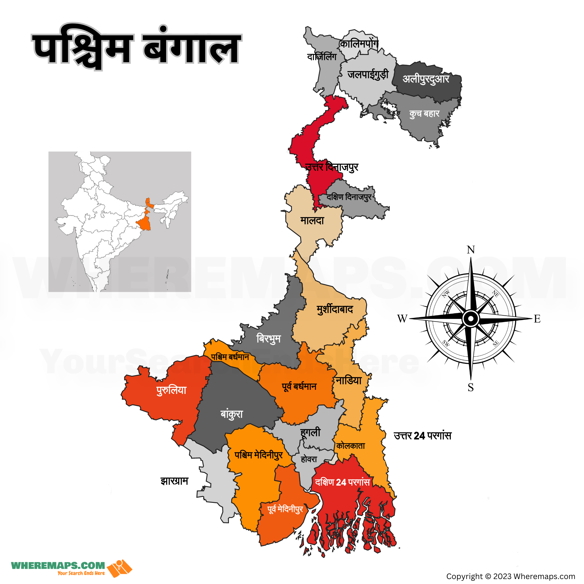
West Bengal District Map in Hindi

List of Districts in West Bengal
| S.N | District | Headquarters | Code | Established | Population (2011) | Population Density | Area Sq Km |
|---|---|---|---|---|---|---|---|
| 1 | Alipurduar | Alipurduar | AD | 2014 | 1,491,250 | 441/km2 (1,140/sq mi) | 3,383 km2 (1,306 sq mi) |
| 2 | Bankura | Bankura | BN | 1947 | 3,596,674 | 523/km2 (1,350/sq mi) | 6,882 km2 (2,657 sq mi) |
| 3 | Paschim Bardhaman | Asansol | BR | 2017 | 2,882,031 | 1,798/km2 (4,660/sq mi) | 1,603.17 km2 (618.99 sq mi) |
| 4 | Purba Bardhaman | Bardhaman | BR | 2017 | 4,835,532 | 890/km2 (2,300/sq mi) | 5,432.69 km2 (2,097.57 sq mi) |
| 5 | Birbhum | Suri | BI | 1947 | 3,502,404 | 771/km2 (2,000/sq mi) | 4,545 km2 (1,755 sq mi) |
| 6 | Cooch Behar | Cooch Behar | KB | 1950 | 2,819,086 | 833/km2 (2,160/sq mi) | 3,387 km2 (1,308 sq mi) |
| 7 | Darjeeling | Darjeeling | DA | 1947 | 1,595,181 | 732/km2 (1,900/sq mi) | 2,092.5 km2 (807.9 sq mi) |
| 8 | Dakshin Dinajpur | Balurghat | DD | 1992 | 1,676,276 | 755/km2 (1,960/sq mi) | 2,219 km2 (857 sq mi) |
| 9 | Hooghly | Chinsura | HG | 1947 | 5,519,145 | 1,753/km2 (4,540/sq mi) | 3,149 km2 (1,216 sq mi) |
| 10 | Howrah | Howrah | HR | 1947 | 4,850,029 | 3,306/km2 (8,560/sq mi) | 1,467 km2 (566 sq mi) |
| 11 | Jalpaiguri | Jalpaiguri | JP | 1947 | 2,381,596 | 837/km2 (2,170/sq mi) | 2,844 km2 (1,098 sq mi) |
| 12 | Jhargram | Jhargram | JH | 2017 | 1,136,548 | 374/km2 (970/sq mi) | 3,037.64 km2 (1,172.84 sq mi) |
| 13 | Kolkata | Kolkata | KO | 1947 | 4,496,694 | 24,306/km2 (62,950/sq mi) | 185 km2 (71 sq mi) |
| 14 | Kalimpong | Kalimpong | KA | 2017 | 251,642 | 241/km2 (620/sq mi) | 1,044 km2 (403 sq mi) |
| 15 | Malda | English Bazar | MA | 1947 | 3,988,845 | 1,069/km2 (2,770/sq mi) | 3,733 km2 (1,441 sq mi) |
| 16 | Paschim Medinipur | Medinipur | ME | 2002 | 4,776,909 | 757/km2 (1,960/sq mi) | 6,308 km2 (2,436 sq mi) |
| 17 | Purba Medinipur | Tamluk | ME | 2002 | 5,095,875 | 1,076/km2 (2,790/sq mi) | 4,736 km2 (1,829 sq mi) |
| 18 | Murshidabad | Baharampur | MU | 1947 | 7,103,807 | 1,334/km2 (3,460/sq mi) | 5,324 km2 (2,056 sq mi) |
| 19 | Nadia | Krishnanagar | NA | 1947 | 5,167,601 | 1,316/km2 (3,410/sq mi) | 3,927 km2 (1,516 sq mi) |
| 20 | North 24 Parganas | Barasat | PN | 1986 | 10,009,781 | 2,445/km2 (6,330/sq mi) | 4,094 km2 (1,581 sq mi) |
| 21 | South 24 Parganas | Alipore | PS | 1986 | 8,161,961 | 819/km2 (2,120/sq mi) | 9,960 km2 (3,850 sq mi) |
| 22 | Purulia | Purulia | PU | 1956 | 2,930,115 | 468/km2 (1,210/sq mi) | 6,259 km2 (2,417 sq mi) |
| 23 | Uttar Dinajpur | Raiganj | UD | 1992 | 3,007,134 | 958/km2 (2,480/sq mi) | 3,140 km2o (1,210 sq mi) |
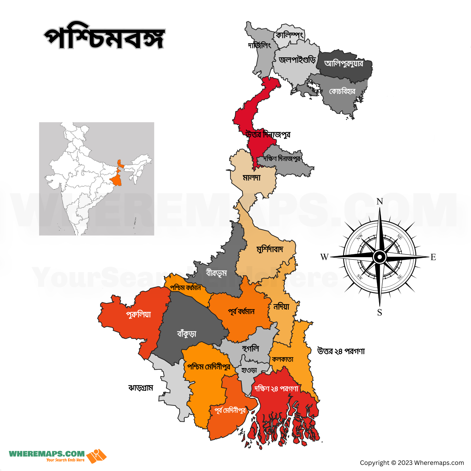
West Bengal District Map in Bengali

Regions of West Bengal District Map
North Bengal
North Bengal comprises six districts – Darjeeling, Kalimpong, Jalpaiguri, Cooch Behar, Alipurduar, and Uttar Dinajpur. This region is known for its tea gardens, hills, forests, and wildlife. Darjeeling, a popular hill station, is located in this region.
South Bengal
South Bengal comprises nine districts – Murshidabad, Nadia, North 24 Parganas, South 24 Parganas, Howrah, Hooghly, Kolkata, East Midnapore, and West Midnapore. This region is known for its historical sites, temples, rivers, beaches, and mangrove forests. Kolkata, the capital of West Bengal, is located in this region.
Kolkata
Kolkata, also known as the ‘City of Joy,’ is a district on its own. It is the cultural, intellectual, and economic capital of the state. The district has many heritage sites, monuments, museums, and markets.
Other Districts
The remaining eight districts are located in different parts of the state. These districts are Purba Bardhaman, Paschim Bardhaman, Birbhum, Bankura, Purulia, Malda, Dakshin Dinajpur, and Jhargram. These districts are known for their agriculture, handicrafts, forests, and hills.

