Arizona is a state located in the southwestern region of the United States, known for its beautiful natural scenery, warm climate, southwestern culture, and outdoor activities. It is home to the Grand Canyon, one of the world’s most iconic natural wonders, as well as a diverse range of landscapes, from deserts and canyons to mountains and forests. The state is also known for its rich Native American history and culture and is home to numerous tribes and reservations. Know more about the Arizona map.
Counties of Arizona
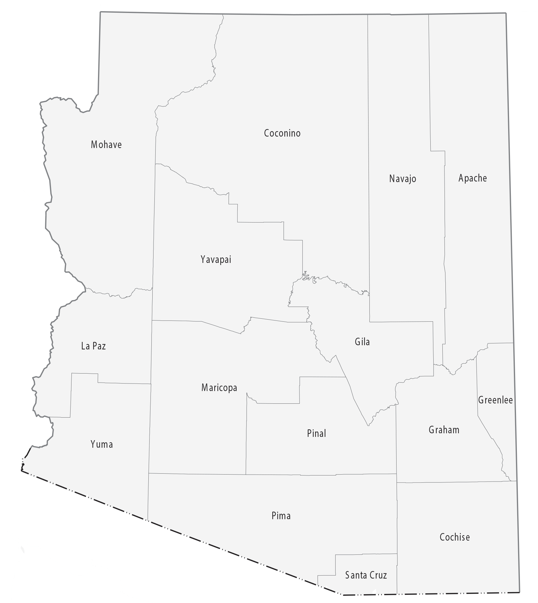
Arizona is divided into 15 counties, each with its own unique culture, history, and geography. From the stunning red rocks of Sedona in Yavapai County to the vibrant city of Tucson in Pima County, each county offers its own distinct attractions and communities. Maricopa County, which includes the city of Phoenix, is the most populous county in the state, while Greenlee County is the least populous. Each county plays a vital role in the economic, cultural, and political landscape of Arizona, and together they form a diverse and dynamic state.
Arizona county list
| County | Area (sq. mi.) | Estimated Population (2022) |
|---|---|---|
| Apache | 11,195 | 71,977 |
| Cochise | 6,219 | 129,088 |
| Coconino | 18,661 | 148,895 |
| Gila | 4,796 | 54,113 |
| Graham | 4,641 | 39,667 |
| Greenlee | 1,849 | 9,756 |
| La Paz | 4,518 | 21,138 |
| Maricopa | 9,223 | 4,730,455 |
| Mohave | 13,311 | 224,039 |
| Navajo | 9,956 | 110,622 |
| Pima | 9,187 | 1,073,854 |
| Pinal | 5,374 | 481,373 |
| Santa Cruz | 1,236 | 46,097 |
| Yavapai | 8,123 | 248,482 |
| Yuma | 5,519 | 216,559 |